Posted August 18, 2013 (edited) Hi Wraith can you add our location hun please .. Its Erin Go Bragh: 18y - 61x on Independance (formerly known as Haitabu Hedeby) Cheers Edited August 18, 2013 by Jilly1 Share this post Link to post Share on other sites
Posted August 18, 2013 hey im tinaskat,mayor of Peaceful Refuge,please add my village on the independence map.The village is located at 25x 60y Share this post Link to post Share on other sites
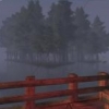
Posted August 18, 2013 http://i192.photobucket.com/albums/z189/rixk/peaceful_refuge_zpsbe6e7f6c.jpg Share this post Link to post Share on other sites
Posted August 18, 2013 Hi there - can you please change the Ravenwood title to Vilewarren at 47x 50y? Just recently acquired the deed. Thanks much! Share this post Link to post Share on other sites
Posted August 19, 2013 (edited) Please add; Grand Bazaar of Constantinople 13y 28x We have a trader on the shore a mailbox as well. I'm located at the upper right corner of our square. Tyverium is actually a little to the south in the same square. Thank you! Edited August 21, 2013 by Arsenic Share this post Link to post Share on other sites
Posted August 22, 2013 Hi, I actually need to change where Dawnrise is! A friend pointed out to me that my coordinates were wrong. My changes are circled red. Weserport - 29x 14y Dawnrise - 30x 16y Thanks! Share this post Link to post Share on other sites
Posted August 22, 2013 Please add; Grand Bazaar of Constantinople 13y 28x We have a trader on the shore a mailbox as well. I'm located at the upper right corner of our square. Tyverium is actually a little to the south in the same square. Thank you! A trader and soon a merchant Share this post Link to post Share on other sites
Posted August 22, 2013 Hello Wraith, I'd like to have my new deed Llamedos added to the map.The coordinates are 27x 44y, since the area is a bit crowded, I made a map with the exact location (the unnamed deed in the red rectangle is my new one) Hope it's not too much of a hassle to squeeze another name into the map there. Thanks in Advance,Merfin Share this post Link to post Share on other sites
Posted August 22, 2013 Dawnrise is actually WEST of kobalt, not south. Share this post Link to post Share on other sites
Posted August 23, 2013 Updated. I left Dawnrise off for now, until it's clearer where it should be. Skyefox, the only ones I didn't do were those that weren't on the map anyway - Lakeside Plantation, Dominia and Angel Shore. Merfin - no matter how hard you guys try, I will always fit the names in that area Share this post Link to post Share on other sites
Posted August 24, 2013 lol wraith its even worse but some neighbours dont seem to want to be on the map and its funny though...because locally it doesnt feel so crowded^^ Share this post Link to post Share on other sites
Posted August 24, 2013 (edited) Finally got round to adding my new deed. Twin Angel Peaks 55x 46y thx Wraith Edit : sorry the pic actually makes it look like its in the edge of the mountains there, it's actaully right on the top of that mountain range. So, just move a touch to the SE. Sorry for the confusion. Edited August 24, 2013 by Milosanx Share this post Link to post Share on other sites
Posted August 24, 2013 Hello. I would like to get my deed to the map. West of Stone harbour ( 45x 48y ) by the coast is my deed. "Ravenstone Harbour". But just for ur infomation, i will soon change name back to Ravenwood, my old deed at 47x 50y. The old deed is bought, and another player named it to something that i dont remember atm. Thanks. - Giblet Of Ravenstone Harbour Share this post Link to post Share on other sites
Posted August 25, 2013 Lol okay I got it right this time. Dawnrise is at 29x 15y Share this post Link to post Share on other sites
Posted August 25, 2013 (edited) Kusumvar is 29x15y ... just north of Dawnrise, just south of Weserport. It has a mailbox too. Edited August 25, 2013 by belacane Share this post Link to post Share on other sites
Posted August 25, 2013 My deed name is Sparta and is located north of Dragon fang Mountain and south of stonehaven there in middle. Cordnates 31y 34x please add that Share this post Link to post Share on other sites
Posted August 28, 2013 SO, its late, i'm bored and I poked into the map a bit just to see what's up with it, and discovered that the insanity area updates from the beginning of this month are rather distorted in terms of deed placement and some roads marked that just aren't very useful. I've marked in red where some of the deed positions need to be moved a bit, those should be fairly self explanatory. Copper cliffs has disbanded long ago. (Mount Vynatubo is where it used to be) I've also circled with a thin blue line parts of the road network that can probably be removed as they are not highways, and even as single lane roads are just incorrect, most likely due to the fact that they don't show well on the dump. I'll detail the differences below, working from north to south: 1- the section under the current placement of Insane Lighting Magic is a 1 lane windy route up to a couple of old deed locations, and the current map lines don't even come close to how twisted it is. 2- the stretch leading up to mount vynatubo is also a single lane path up the south side of that mountain. 3- the little switchback west of Insanity valleys is a single lane path that leads up to part of the Insanity Hills deed. 4- the stretch down to "The Eve of Insanity" area is single lane, and again, much more twisted than that. I did not mark it on the corrected map above, but the bay hills east deed is actually overtop of the east end of the bay hills canal (more or less,) and the spot you have it placed in is where bay hills itself was years ago. While poking around the thread, I also ran into the references to FRAM, a project that I was heavily involved in when it was active. FRAM was removed from the forum pin list because it was simply out of date, and no longer being worked on. The player who was organizing it just simply... stopped. I think the thread itself was lost in one of the forum moves. Incidentally, the mapping of the Highway south out of Insanity along the west of the water from the FRAM map linked on the wiki should still be accurate at least to as far as where bay hills is to the east, and south to havilah/dark forest, since when I built it I cut into the side of mountain cliffs as much as possible to avoid wasting useful land and as a result its pretty much impossible to re-route. The Highways(2 wide roads) INSIDE the main Insanity area (from Insanity Port to the north down to Insanity Hills South Harbor) are almost completely deeded and so remain intact. The smaller roads detailed around the Insanity Hill deed and the Insanity Port deed are most likely incorrect however, since several years of remodels will have caused movement in most of them. 1 Share this post Link to post Share on other sites
Posted August 28, 2013 I'll make the specific adjustments you have suggested Spellcast (namely, moving the deeds and removing the roads that are blue-circled). I won't be going through the FRAM thread trying to make changes - similar to the map dump this will be out of date and I'm not going to make changes based on out of date information. Updates should only be posted if someone has visited a location just now and they can reliably state that things are a certain way Note to everyone:Obviously I'm not going to run around checking every update people suggest in the game, so I rely on the accuracy of peoples' posts - please double-check your additions as it's tiresome for me to go back and change the same thing again when it turns out to be wrong. Share this post Link to post Share on other sites
Posted August 28, 2013 Heh, I wasn't suggesting you try to update the whole map with FRAM information, simply that since the coastline around insanity has been more or less corrected, if you want to use that specific portion of the FRAM map to lay in the main highways without some of the odd distortions it should be possible now since they haven't moved since I built them and then mapped them for FRAM. IF not, no big deal as that part of the map has had badly distorted road marks for years anyhow. (I tried on several occasions to edit the old coastline of the map so they could be corrected, but that was one area that was just too distorted to correct easily and I didn't have the time to merge the raw data with the original Darkmalice map, or rather whenever I did it overlapped other areas and was just a massive pain to fix.) WIth that said, Lycanthropic, if you want to send ME that file you are referring to via forum pm, I will take a look at it and see if it sparks my memory as to what it is and if it is something allowable to post on the forum. I was quite active with mapping the server at that time, and occasionally my memory does work. EDIT: oh, and having a GM fly up high and take a picture wont help you get a better map hugh, rolf does the dumps a different way, a GM flying really high would be far too distorted to be of any real use, as instead of a top down view, what you would get is a center out view like a player would get from the top of dragon fang, except from a bit higher up. trust me, detailed mapping is not any easier with a GM toon. =D Share this post Link to post Share on other sites
Posted August 30, 2013 (edited) SO, its late, i'm bored and I poked into the map a bit just to see what's up with it, and discovered that the insanity area updates from the beginning of this month are rather distorted in terms of deed placement and some roads marked that just aren't very useful. Gud day spellcast and wraithglow, 1st for spellcast... part two for wraith below ty, ty, ty, ty, ty!!!!! Those corrections to my efforts are appreciated. Do stop by for a meal next time you are near by. So you (and others know). As a person who has professional training in cartography, i am trying to correct for the elevation caused off set of roads and locations due to the 30 degrees from vertical the dump image was capture from. North south roads are okay, east west roads can be a challenge. A map is meant to be representative and in some cases a twisty switch back road can not be reproduced accurate due to the scale we are working with. It would look like a catapillar had drooled all over the place after a night at the pub with his mates. So a straight line suffices where it is impossible to put in a a ton of twists and turns. I show there is a road, there is jsut not the room at the scale of the indy map to show all the twists and turns... thus a representive line that says there is a road here... As for FRAM, it is brillient but as it is from 2009, I am only using it for geography that that is hiddend from view behind mountains that hide stuff due to the viewing angle of the dump map image. I am basing coastline on a combination of actually sight seeing shoreline crawling and the map dump. I welcome all corrections as wurm as changed in the 18 months since Rolf did the dump. For highways, on the dump they look zig zaggy due to the viewing angle, as they run up and down the hills and valleys. But many in fact are dead straight. The folks who are the highway engineers of Wurm have worked mircles. So.. i take a road's "sealevel" end as the start position for an east west road as the Sealevel start will be in a fair accurate position its sea level end. "IF" the road is straight, I draw a straight lien to the east of west from the sea level start position. The dump shows many roads zig zagging all over as they go up and down hills, but in fact they are dead straight. Of late, my wife and i have taken to "inland" exploring to verify where deeds are in relationship to the roads and we Only use those deeds that are on the current Indy map. Deeds that are not listed will retain their desired privacy. I can not express enough my appreciation at you venturing up into those mob infested hills to get up to up to date data. Yes, I am a non-combat orientated player and love Indy for its "relatively" low mob density. Thank again for getting the correct deed locations up around Insanity. As my wife and i get braver, we will try to get more accurate road placements for the Indy map project further from the shore line. I welcome all updates to the stuff I submit. Thank you to all for helping out. 2nd part for wraitglow I will be in touch shortly.... with more area updates... yes I am using the FRAM as explained above to fill in the hidden parts. Currently I am finished the whole eastern half of INDY at sealevel. When I am done, I will contact you via forum PM to arrange to send to you set of full set of identical to the map sized PNG's. As I now know you are now working in layers, one will be geography Only, no roads, no deeds, but at the same scale of the existing map, so you can just import it as a new layer and then move it down under the existing roads and deeds layer. We (my wife and I) are working on the secondary layers, one for roads and guard towers only, one for deeds and their names only. It should make it easier to move stuff around. As you try to squeeze in everyone who wants their deed to be shown on the map. We hope this will help to make your life easier. Warmest regards! Hughmongus surveyor/cartographer volunteer helper for the Indy map team. Edited August 30, 2013 by HughMongus Share this post Link to post Share on other sites
Posted August 30, 2013 (edited) Gud'day Wraithglow... my wife and i did a bit of exploring today and verified the following deeds not longer exist. Green Hill .......... at 37x, 18y is a very ong time gone, only slabs left where it was..Kunibert Ranch.. at 37x, 19y is a very long time gond, only slabs left where it was. But before you delete Ranch, can you place a guard tower at the lower right corner of the "h" in Ranch, we found a nice guard tower there, tucked into NE corner of that Square. Also there is a nice two tile highway down south from Norrljus to edge of the mountain (rock on map) due south of Norrljus. This meets up with a nice single lane road that follows the mountain from Pest Harbour as far as the left edge of the "dip" that bulges south into the mountain there at 39x, 20y. Hope this is of some help to you. Cheers! Hughmongus Edited August 30, 2013 by HughMongus Share this post Link to post Share on other sites
Posted August 30, 2013 Af Reality and Purgatory on the Eastern Plains (40y) are both gone. White Run and 53x,33y is gone.Lhant at 53x,31y is gone. Share this post Link to post Share on other sites
Posted August 31, 2013 I can not express enough my appreciation at you venturing up into those mob infested hills to get up to up to date data. Yes, I am a non-combat orientated player and love Indy for its "relatively" low mob density. Lol, what venturing. Insanity is my home. Me and my alliance placed most of those deeds and built those roads, so it wasn't hard to correct them. =P Share this post Link to post Share on other sites
Posted September 1, 2013 Goodday Wraith, would like to ask you to put Redneck Stables back on the map. Redneck Stables (49x, 44y) Thanks *Tips hat* Share this post Link to post Share on other sites